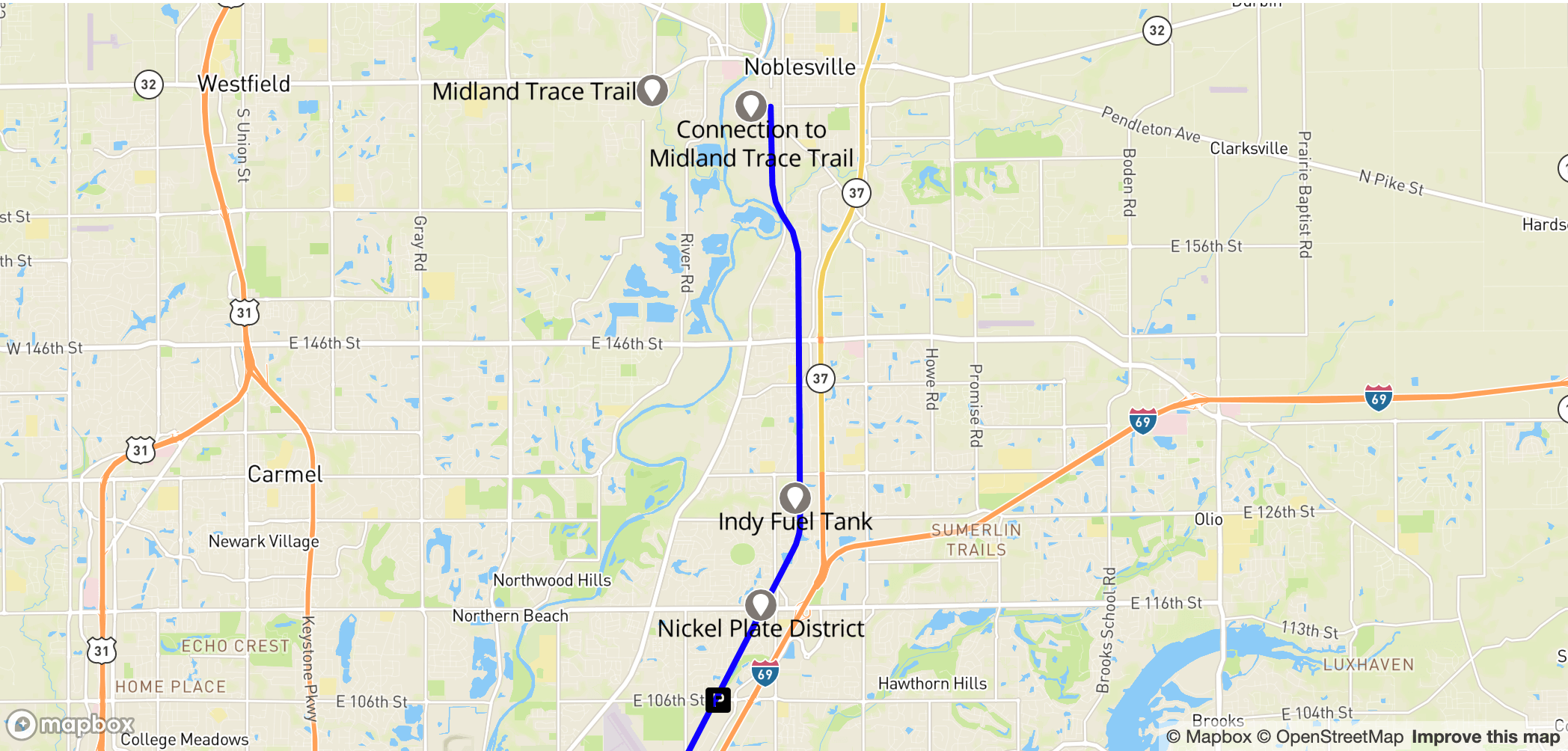
As winter descends upon Indianapolis, trails are probably not on many people’s minds. However, exercise is still important, and a new opportunity to consider once the weather improves is the recently opened Indianapolis section of the Nickel Plate Trail! On October 21st, 2025, a ceremony was held and attended by Mayor Joe Hogsett to celebrate the official opening of the trail from 42nd to 75th St.
The $14.9 million project is a mixed-use trail going from the State Fairgrounds all the way northeast into Fishers. The Nickel Plate is practically another Monon, being a trail converted from an old rail line which aims to be a safe and attractive place for walking, running, and biking.
To find out the character of this new trail and some of its new features, I took a bike ride across the whole of the Indianapolis section, taking photos and conducting interviews with locals about their opinion of Indy’s newest greenway. This expedition was conducted on November 5th, so it may have changed by your future visit.

Local residents and newcomers alike greatly appreciate the new trail. Local Denise Hasper praised the numerous positive aspects of the trail:
“Oh, it’s wonderful! It’s just a real good addition to the neighborhood. I can walk my dog on here everyday, we’re healthier because of it, and they keep it clean.”
Other nearby residents concurred, stating that they often walk it several times a month. A couple young people experiencing the trail for the first time also agreed with Denise’s sentiments:
“I feel like it’s a pretty good addition; it allows people to get into nature, to walk their dogs.”
While it wasn’t very busy at the time of my visit, the testimony of its users is evidence of the trail’s favorable qualities and the large positive impact it could have on locals and the city at large.

The trail begins at 42nd Street, intersecting the Monon at the northwest corner of the State Fairgrounds. This connection makes it easily accessible for anybody living near the central part of the Monon.

After heading eastward for about a mile on the Nickel Plate (just above the Fairgrounds), the trail begins in earnest at the end of 42nd Street, with a small plaza area (above) complete with a map and water fountains. There is also parking nearby–this would serve as the trailhead for anybody driving in.

The picture above shows the composition of the trail for the majority of its length–very akin to the Monon, as it is flanked by tall trees on both sides and heads through a variety of residential and commercial areas. The actual trail is a little smaller width-wise than the Monon but it is still perfectly sufficient. At the time of my journey there were few people on it as the trail seems to not be widely known yet.


Every quarter mile there are clear mile markers for the trail with an emergency code in case you need to signal your location to first responders. At certain trail entry points these signs are upgraded with maps of the local area, and at these locations there is also a bench, trash can, and dog poop bag dispenser.

The dog poop amenities on the trail are particularly notable. There are dog poop bag dispensers every so often on the trail and metal cans to dispose of the waste, which is very handy for animal-lovers looking to enjoy the Nickel Plate. Overall, in terms of actual amenities for its users, the Nickel Plate trumps Indianapolis’ other trails, and hopefully these resources will be maintained far into the future.

Right before 46th Street is Black Circle: a bar, music venue, and distillery. It could serve as a good stop for food for trail users on the Nickel Plate. Besides the major intersections the trail crosses, there aren’t too many businesses along the way–but perhaps the trail will encourage more development in the future.


Unfortunately the Nickel Plate Trail is not all smooth sailing. Because of its northeastern direction it eventually has to bear with some nasty intersections. The first of these is at 46th Street, where heading north one must turn right and then cross Keystone Avenue. The crossing is very busy and could be dangerous if any drivers are not paying attention. Fortunately, while this is currently not ideal, there is a long term plan to avoid this intersection. Funding has been procured for a pedestrian bridge across Keystone, which would avoid this intersection entirely, but according to the Indianapolis Department of Public Works, construction won’t begin until 2027. So until then the current crossing will have to be navigated.

At the smaller road crossings however, the Nickel Plate actually does relatively well. At many streets such as 49th shown here, HAWK (High intensity Activated crossWalK) signals help make things safer for pedestrians. Pressing the button turns on a yellow and later red light for cars, while legally allowing them to proceed if a pedestrian has already crossed. The effectiveness of HAWK signals has been proved elsewhere so it is exciting to see them coming to Indy.

The Nickel Plate also adapts to some of its more unique circumstances. For example, while passing through the industrial area above, there are signs to warn trail goers of possible cross traffic, similar to ones on the Monon.

While officially open, the trail is not entirely complete–even in the designated areas. At the time of my visit, caution tape still adorned the inert crossing lights at the Kessler crossing. These and other assorted minor issues with the trail will likely be mopped up soon.


The next major intersection of concern is 62nd and Allisonville. This road, while still busy, isn’t quite as hectic as Keystone. Because of this, funds have not been appropriated for a bridge. The two main issues with this crossing are a large bush outside the Speedway gas station that could obscure pedestrians from exiting cars, and the fact that to remerge on the Nickel Plate both sides of the intersection must be crossed. Confusing this even further is a smaller trail running perpendicular to the Nickel Plate, so if continuing north or south make sure to cross twice.

The shape of the signs at the 65th Street crossing would imply HAWK signals, though it seems those have not been installed yet. No other crossing has such yellow signs in place of HAWK signals so it would be assumed this is a temporary affair.

For many residents however, the permanence of the trail has already set in. Across the trail, one will come across many small bridges and stairs leading to homes, providing easy access for their residents. The Monon has a large number of these small bridges and they show how local neighborhoods are interacting themselves with the trail. It should be noted all of these improvised bridges are those of private homeowners, and they should not be used without permission.

A little past the official end of 75th and the fate of the trail is laid bare. Ongoing construction at the nearby I-465 interchange has led to a lack of progress on this part of the trail and it will remain closed until the interchange work hopefully finishes sometime in 2026.

Intrepid adventurers can attempt to navigate the closed section, where the only infrastructure issue is a lack of pavement. However this should be done at one’s own risk and I certainly don’t recommend it on any work days. At the moment unfortunately there isn’t even much gain past the interchange, where afterwards the trail runs into 82nd Street, a highly busy crossing that is expecting a pedestrian bridge in 2027. Even beyond that it is not smooth sailing as 96th Street currently serves as a near impenetrable barrier for any pedestrians looking to head into Hamilton County and experience the Fishers part of the Nickel Plate. The complete lack of pedestrian infrastructure at the county line has necessitated a pedestrian bridge and thankfully construction on that has been going well. The bridge is in good order and is set to open by the end of the year, though delays could materialize.


The old rail line may be gone, but in its place a splendid addition to the community has arisen. Remnants of the track can still be seen, but the dominant mood on the trail is one of opportunity. In the future, a vibrant community is likely to develop around this new artery of the city, increasing all residents’ quality of life.